UPDATED
July 15, 2002
|
|
|
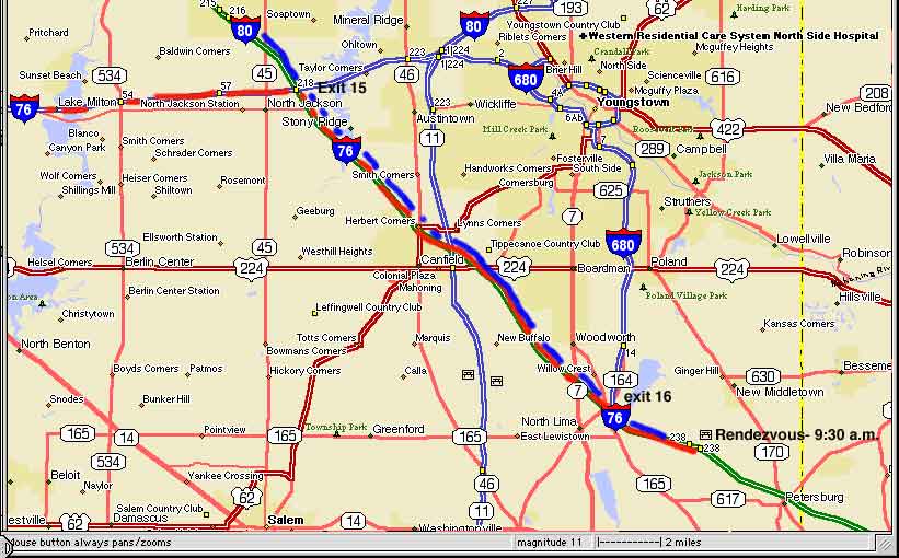
| Rendezvous Point | Map 1 |
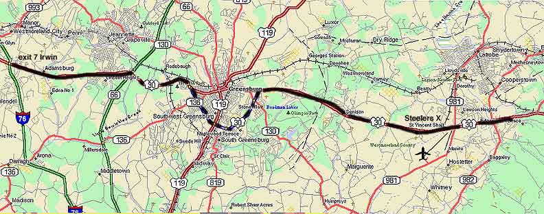
| Pa Pike
- Irwin to Latrobe |
Map 2 |
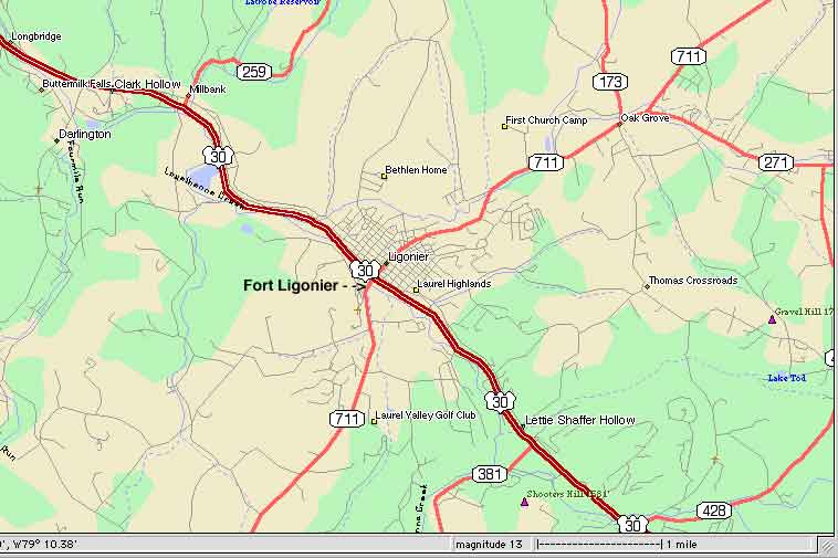
| Fort Ligonier | Map 3 |
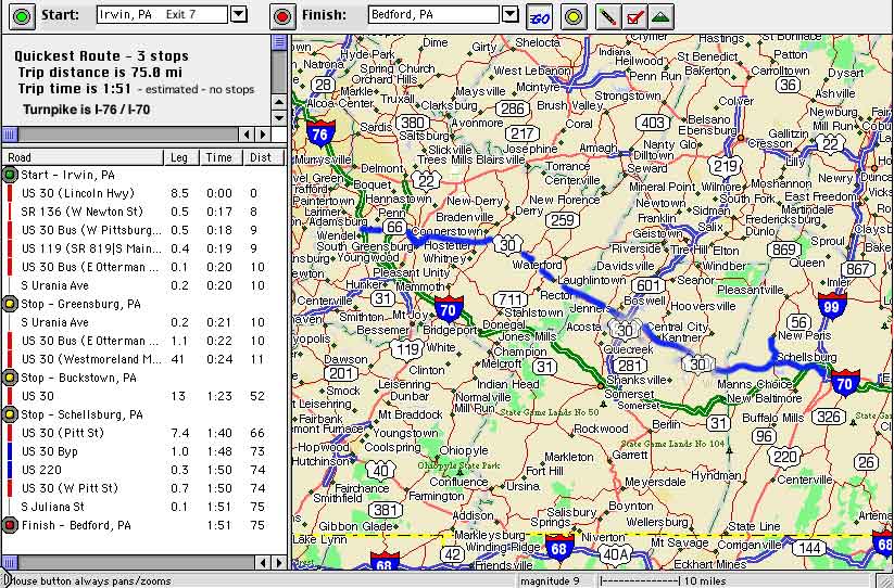
| Irwin, Pa (exit 7) to Bedford, Pa | Map 4 |
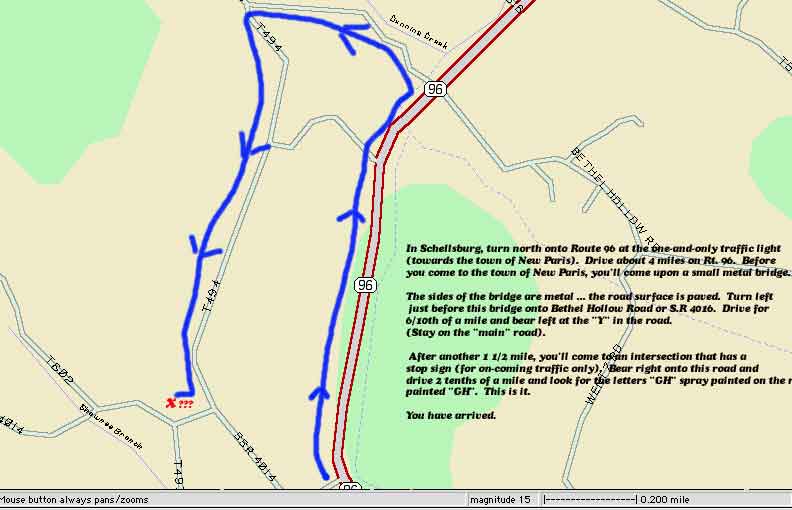
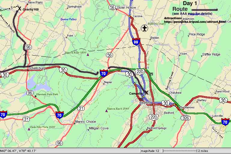
| - Gravity Hill | Map 5 |
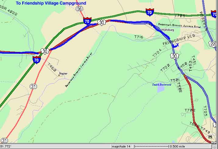
| - Gravity Hill - Bedford Camp | Map 6 Map 6a Camp Information |
|
|
. |
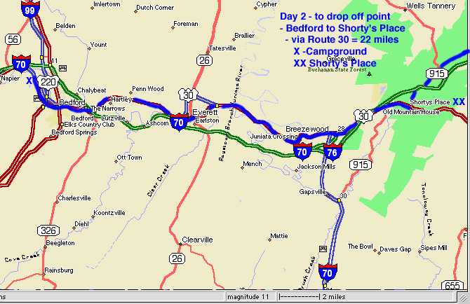
| Bedford to Shorty's Place | Map 7 |
| Directions to Sideling Hill/Cove Plaza | Map 8 |
| - - Tunnel pick up Point | Map 9 |
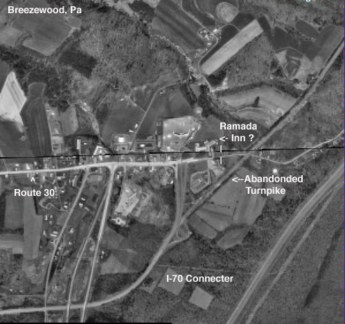
| - - Aerial View of above map | Aerial View |
| - - Abandoned Pa Pike | Map 10 |
|
|
. |
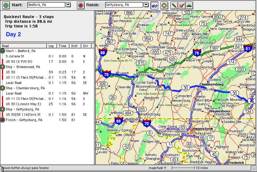
| Bedford to Gettysburg | Map 11 |
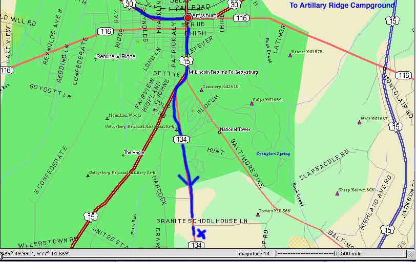
| - - - Artillery Ridge Campground | Map 12 Camp information |
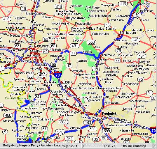
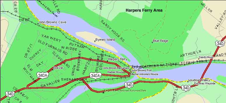
| Harpers Ferry / Antietum Loop | Map 13 |
| - Harpers Ferry | Map 14 Information |
|
|
. |
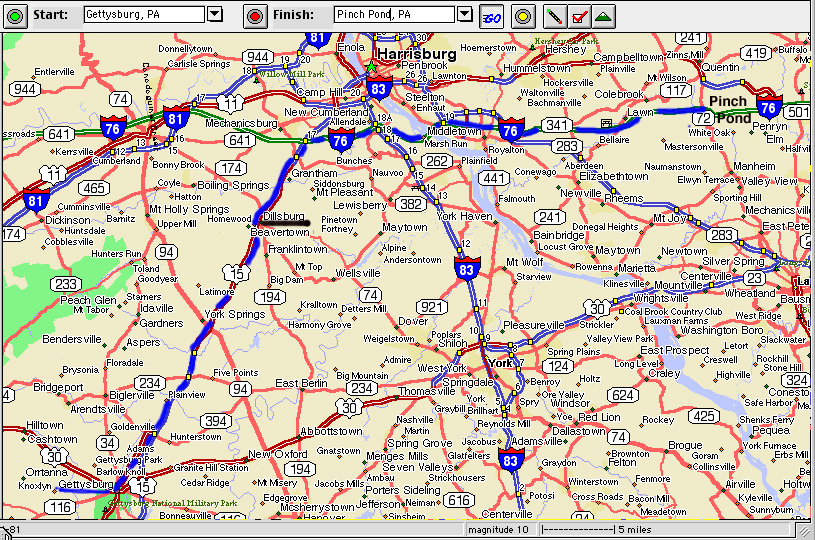
| Gettysburg, Pa to Pinch Pond, Pa | Map 15 |
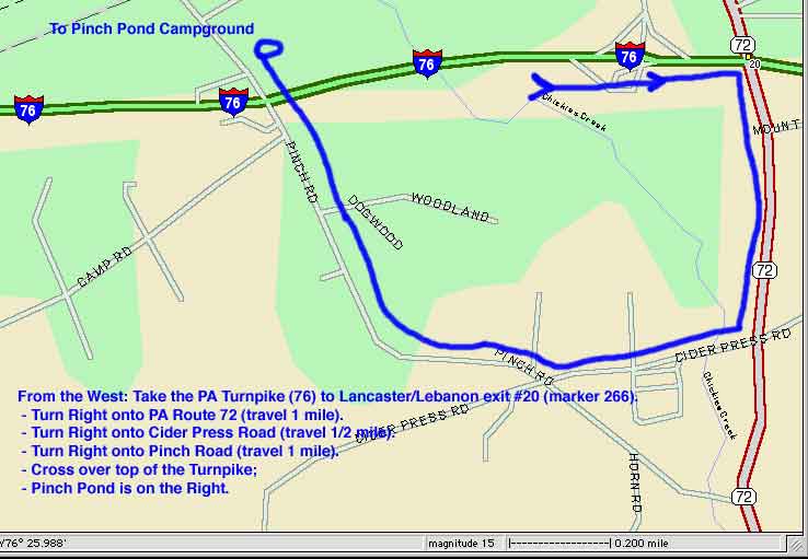
| - Local to Pinch Pond | Map 16 Camp Information |
|
|
. |
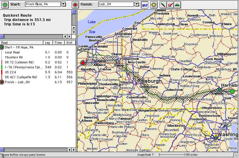
| Pinch Pond, Pa. to Lodi, Ohio | Map 17 |